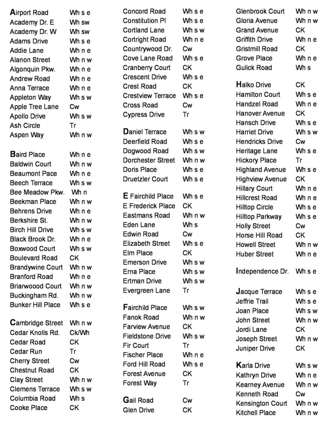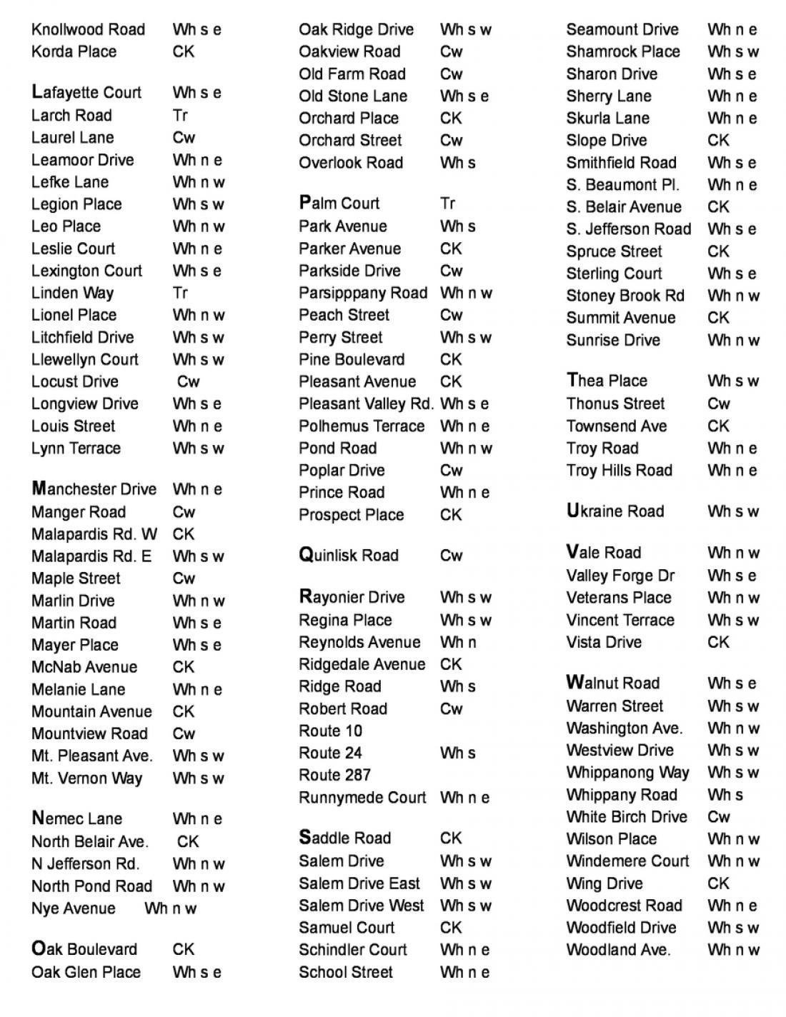
Find the street and section you are looking for
and Hover your mouse over that section of the map to magnify it.
(on a mobile device— tap the map to magnify)


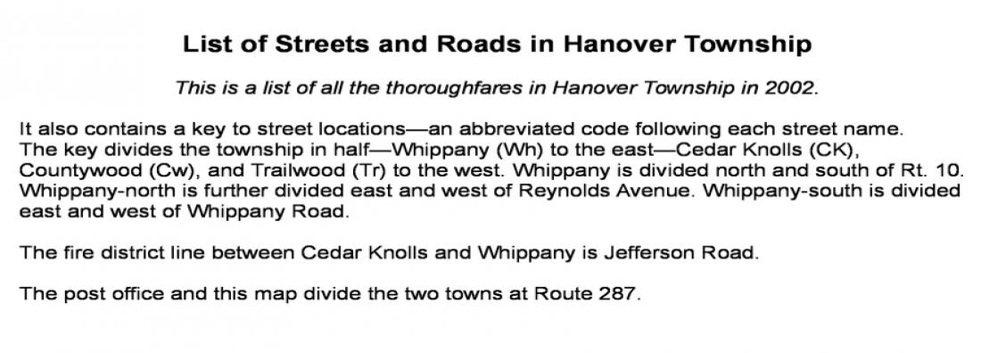
The Street Map is color-coded into seven sections
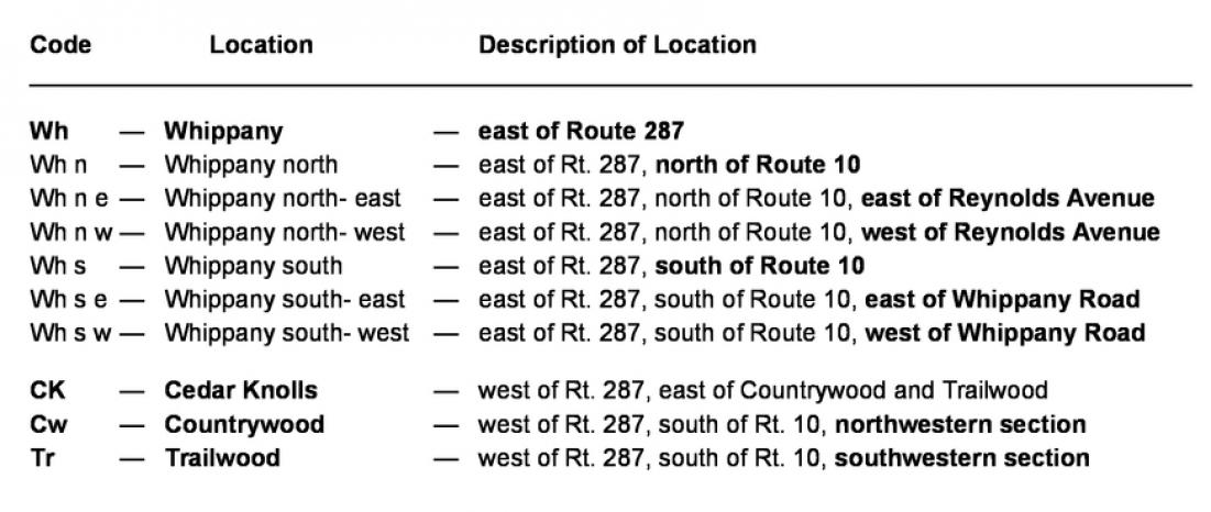
The Index of Streets (below) contains a location code after each street name— Countrywood, Trailwood, Cedar Knolls, Whippany northwest, Whippany northeast, Whippany southwest, and Whippany southeast.
From left to right— ►white is Countrywood, ►gray is Trailwoods, ►yellow is Cedar Knolls, ►white is Whippany south– also devided into Whippany southwest and southeast, and ►gray is Whippany north– also divided into Whippany northwest and northeast.